
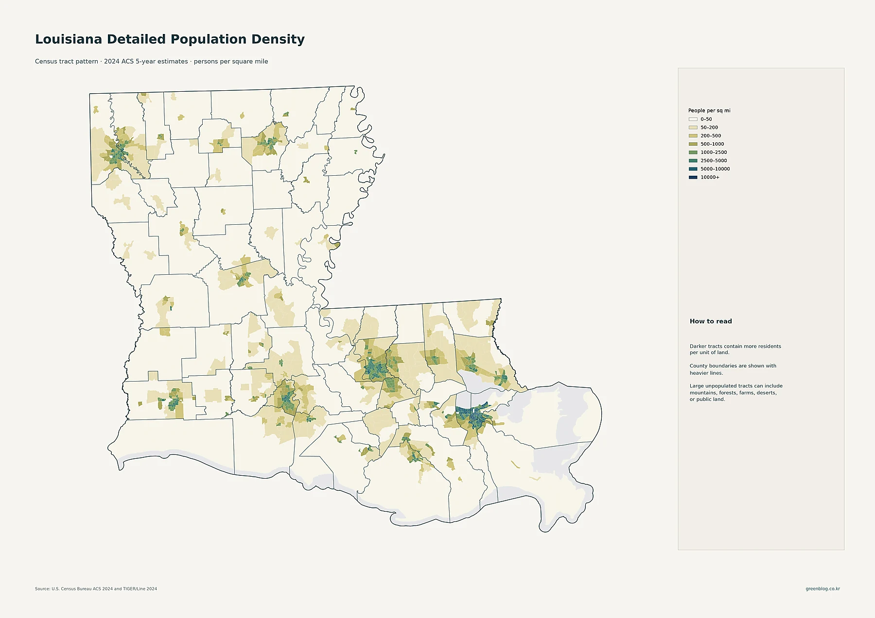
Louisiana's population of over 4.6 million is not evenly spread; it clusters heavily in specific urban hubs while vast rural areas remain sparsely populated. Understanding the state requires looking beyond simple averages to examine census tracts, parish totals, and decade-to-decade shifts.
Urban Clusters and Parish Rankings
The 2024 American Community Survey data reveals that Louisiana's average density of roughly 107 people per square mile masks significant regional variations. While the state contains 64 parishes, population concentration is strongest around New Orleans in Jefferson Parish, Baton Rouge in East Baton Rouge Parish, and Lafayette. Census-tract maps illustrate this by showing how high-density cores exist within broader low-density areas, particularly in southeastern Louisiana where tracts exceed 5,000 residents per square mile. Conversely, northern and central regions feature extensive low-density territory. When ranking parishes by total population, East Baton Rouge leads, followed by Jefferson and Orleans. However, density rankings differ; Orleans and Jefferson hold the highest parish-level densities, creating a sharp contrast with rural Louisiana.
City Sizes and Historical Growth
Beyond parishes, the state's major urban centers show distinct population sizes based on 2024 ACS data. New Orleans remains the largest census place with 371,853 residents, significantly larger than Baton Rouge (222,771) and Shreveport (180,982). Other notable cities include Metairie, Lafayette, Lake Charles, and Monroe. While parish population rankings remain stable, historical growth rates tell a different story. The 2010 to 2020 Decennial Census indicates that St. Bernard Parish experienced the fastest percentage growth among all parishes. This rapid expansion contrasts with several northern and central parishes that saw sharp population declines during the same period, highlighting how demographic trends vary even within the same state.


0 댓글