
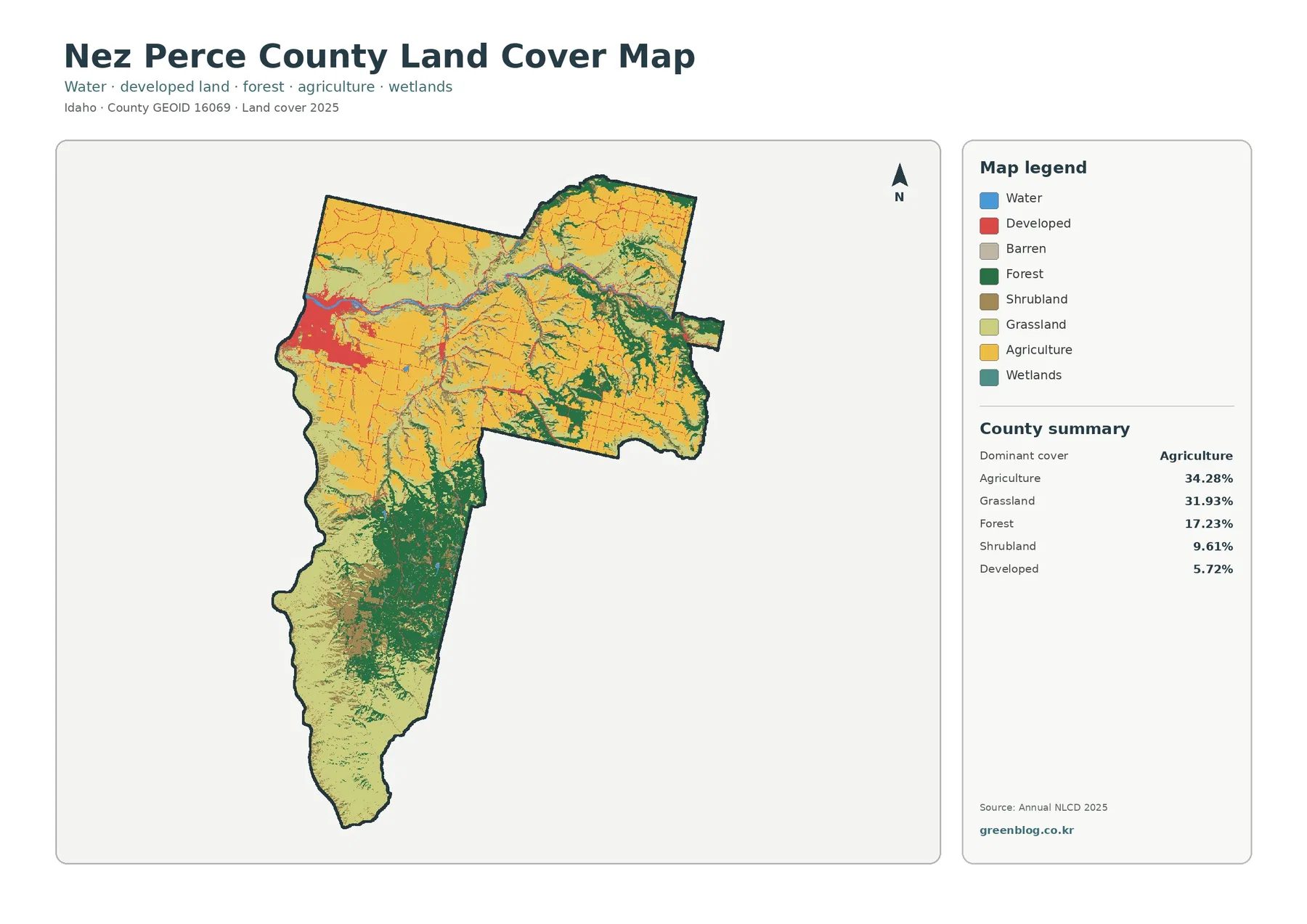
Nez Perce County presents a diverse landscape where agriculture and grassland dominate the terrain, while developed areas cluster tightly around Lewiston in the northwest.
The Agricultural Heartland and Urban Cluster
Agriculture accounts for 34.28% of the county's land cover, closely followed by grassland at 31.93%, creating a combined two-thirds coverage of crops and open vegetation. These yellow agricultural areas span the north, center, and eastern regions but are fragmented by drainage lines and shrubland rather than forming continuous blocks. Forest covers 17.23% of the area, becoming increasingly prominent in the southern uplands, while shrubland occupies 9.61%. In contrast, developed land totals only 5.72%, concentrated sharply around Lewiston where the Clearwater and Snake rivers meet. Although impervious surfaces average just 2.00% countywide, they are most visible near this urban center. The maps clarify that these percentages represent satellite-derived land-cover classes like crops or grass, not legal zoning or specific crop types such as wheat or canola.
Comparing Past and Present Land Changes
The 1985 to 2025 change map reveals a 16.76% difference in land-cover classes, yet this figure does not indicate that 16.76% of the county was physically converted between those dates. Instead, it highlights shifts in classification categories across the region. To orient the maps effectively, observers should start with the northwest corner near Lewiston to locate water corridors and developed clusters, then move southward to observe the transition from farm country to forested terrain. The four available JPG maps allow for printed reference sheets or classroom comparisons of impervious surfaces versus natural cover. Users must remember that these visualizations describe ground conditions classified from satellite data and should not be used to identify specific addresses or determine where development is legally permitted.
Download all four JPG maps for Nez Perce County land cover analysis


0 댓글