
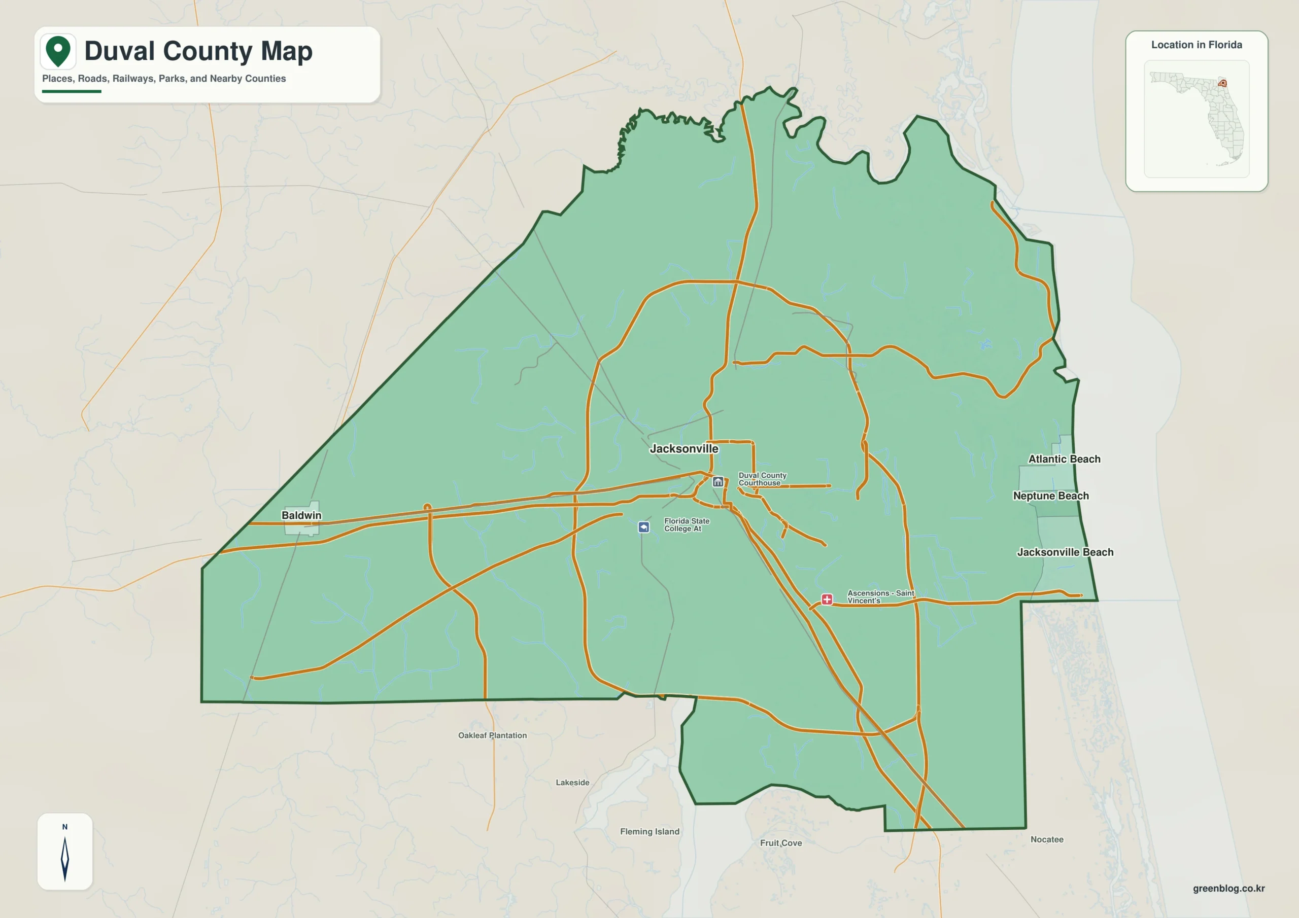
Understanding Duval County requires viewing Jacksonville alongside the St. Johns River, three Atlantic beach cities, and Baldwin. While the city and county governments consolidated in 1968, distinct municipal boundaries remain for Atlantic Beach, Neptune Beach, Jacksonville Beach, and Baldwin.
Geographic Layout and Municipal Distinctions
The county's geography is defined by the St. Johns River, which flows north through the urban core before bending east toward the ocean. Major highways like I-95 and I-10 anchor downtown Jacksonville, while I-295 forms a wide suburban loop. Unlike the central cluster, Atlantic Beach, Neptune Beach, and Jacksonville Beach form a compact coastal group separate from the inland city. Baldwin serves as the isolated western municipality near the Baker County border. Although Jacksonville occupies most of Duval County due to their 1968 consolidation, these four entities retain independent municipal status, creating three distinct administrative zones within the county.
Water Systems and Natural Landmarks
Beyond roads, the St. Johns River acts as the primary natural reference point, linking downtown, port facilities, and the northeastern marshes. The river's tidal influence extends from the lower Jacksonville reach to the Atlantic outlet. Smaller drainage systems like the Trout River in the northwest and the Ortega River from the southwest further divide the inland landscape. These waterways, along with features such as Holly Oaks Lake and various creeks, illustrate a complex network of wetlands and channels that complements the highway infrastructure for regional orientation.


0 댓글