
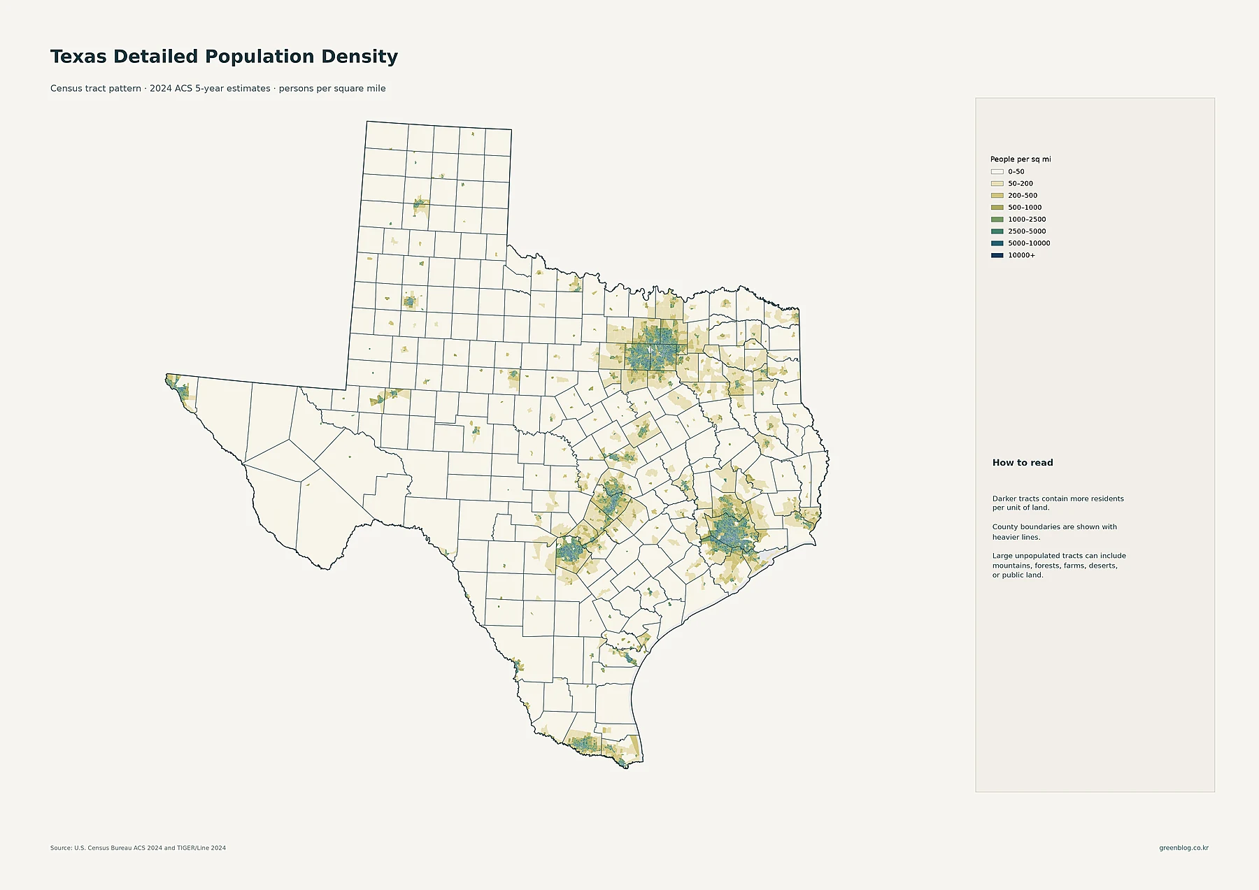
Texas hosts over 30 million residents across a massive land area, creating a unique landscape where four major metro hubs coexist with vast sparsely populated regions. While the state averages roughly 116 people per square mile, this figure masks extreme internal variations between densely packed urban centers and isolated rural areas.
Major Population Centers and Growth Trends
The state's population is concentrated in four dominant systems: Houston, Dallas–Fort Worth, Austin, and San Antonio. Harris County leads in total residents with nearly 4.84 million people, though Dallas County holds the title for highest density at approximately 3,002 people per square mile. Growth from 2010 to 2020 was fastest in Hays County, highlighting suburban expansion along corridors like Austin–San Antonio and metro fringes. Major cities include Houston with over 2.3 million residents, followed by San Antonio and Dallas, while smaller urban centers like El Paso and Corpus Christi form distinct regional clusters separated by low-density zones.
Density Disparities Across the State
With a total land area of about 261,259 square miles, Texas presents a stark contrast between its largest counties and its smallest. While Loving County contains only an estimated 33 residents, Dallas County packs over 2.6 million people into a much smaller footprint, resulting in the state's highest density. Other high-density areas include Harris and Tarrant counties, whereas western Panhandle counties like Amarillo and Lubbock exist as urban islands within broad expanses of sparse settlement. The data reveals that total population size does not always correlate with density, as land area differences significantly impact the average people per square mile across the 254-county state.


0 댓글