
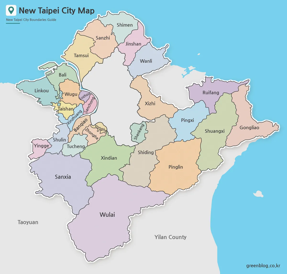
New Taipei City serves as a vital extension of the greater Taipei metropolitan area, encompassing approximately 2,052 square kilometers and home to over four million residents. Unlike a compact urban center, this special municipality features a diverse landscape ranging from dense districts bordering Taipei City to expansive coastal towns and mountain communities. Understanding its layout requires more than a simple location reference; it demands a clear view of how distinct regions function together.
Understanding the Municipal Layout
The geography of New Taipei City is defined by its relationship with Taipei City. While districts like Banqiao, Xinzhuang, Zhonghe, and Yonghe form a tightly connected urban core near the capital, other areas possess unique identities. Tamsui, Ruifang, and Wulai are characterized by their coastal or mountainous nature, often serving as key tourism destinations. This contrast between central density and outer natural areas makes a detailed district map essential for anyone studying Taiwan's administrative structure or planning travel routes.
Map Versions for Specific Needs
To accommodate various uses, three distinct map styles are available: a color district map, a black and white version, and a blank outline. The color map excels at visually separating compact urban zones from wider outer areas, making boundaries clear for presentations and blog graphics. For printed documents and classroom materials, the black and white version offers a cleaner layout that handles crowded central labels effectively. Finally, the blank outline provides a neutral base for users to add custom routes, statistics, or markers, ideal for infographic projects or travel planning.
Practical Applications
These maps serve diverse purposes beyond simple reference. Educators can use them to explain the Taipei metropolitan area's complexity, while travelers benefit from seeing how day-trip destinations like Wulai fit into the broader city structure. Designers find utility in the outline version for creating custom visual content, ensuring that the full shape of New Taipei City remains readable without overshadowing specific district details.


0 댓글