
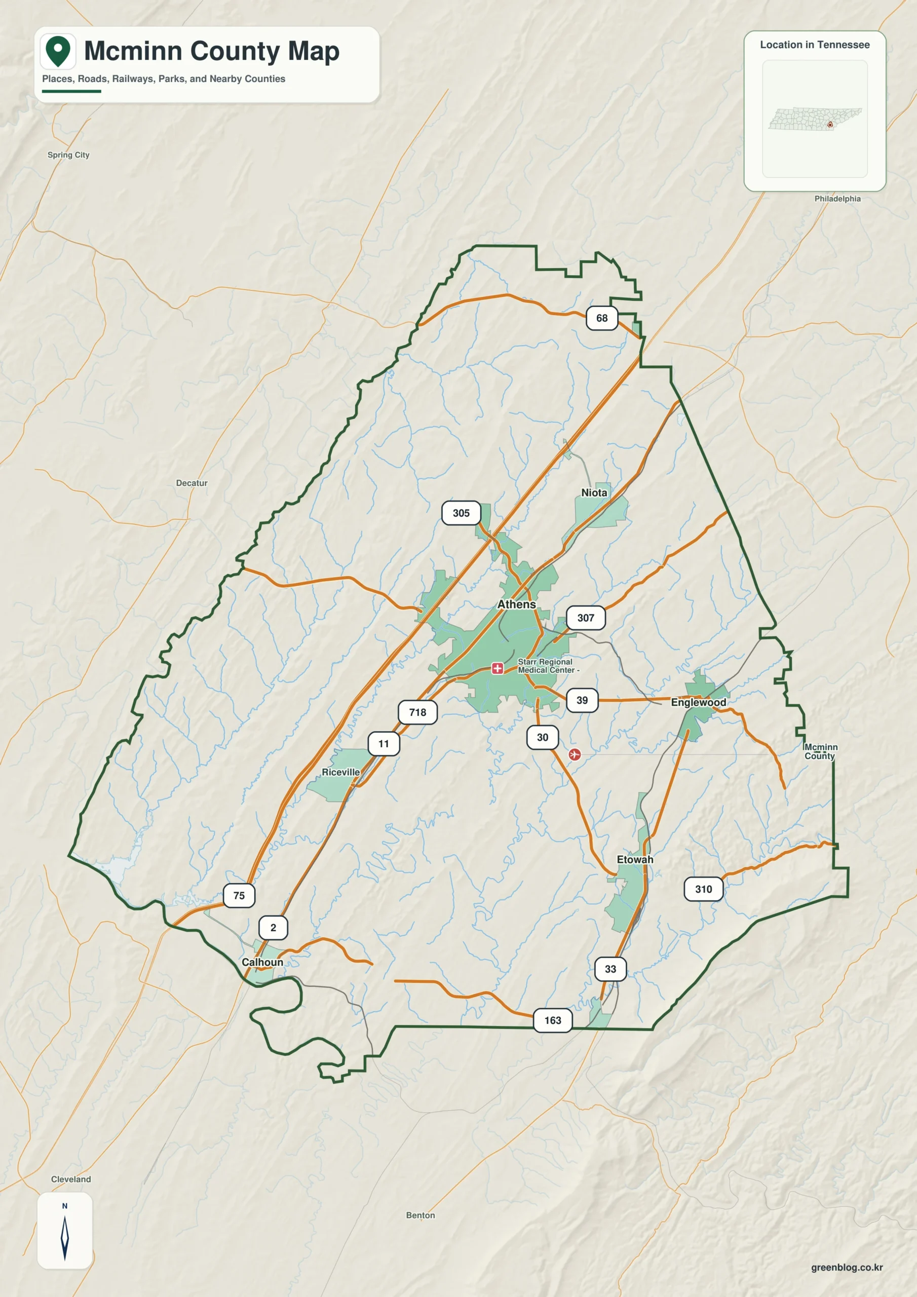
Understanding McMinn County requires viewing it not as a circle around Athens, but as an elongated landscape of distinct valleys and ridges where major towns like Niota, Englewood, Etowah, and Calhoun sit along separate road corridors.
Geographic Structure and Town Distribution
The county's physical character is defined by a strong contrast between low green valleys rising to ridges that reach approximately 708 meters near the southeastern edge, while the lowest points sit around 197 meters. This topography dictates that many roads follow a consistent southwest-to-northeast grain, creating connected valley corridors rather than a standard street grid. Athens serves as the primary anchor in the central-eastern region, intersecting with I-75 and numerous local routes including numbers 11, 30, 39, 68, 163, 305, 307, 310, and 718. While Athens is the county seat, other significant settlements are positioned at varying straight-line distances: Niota lies roughly five miles northeast, Englewood about seven miles east, Etowah approximately nine miles southeast, and Calhoun extends to fourteen miles southwest. These locations often appear close in direct distance yet remain separated by distinct terrain features, making the county's shape more of a long diagonal arrangement than a compact cluster.
Hydrology and Elevation Layers
Water features play a critical role in defining the county's interior, anchored by Chickamauga Lake on the western side. A dense network of creeks traverses the center, with North Mouse Creek being particularly prominent for its long drainage path through the southwest-central region. Other labeled waterways include Rogers Creek, Spring Creek, Oostanaula Creek, Little North Mouse Creek, Middle Creek, Chestuee Creek, Cane Creek, and Conasauga Creek near the southeast boundary. Smaller bodies of water such as Webb Lake, Blazer Lake, L and N Reservoir, and Mountain View Lake occupy narrower valleys within the county. The elevation data reveals a dramatic rise from the western lowlands to the high southeastern ridge, creating two distinct water settings: the broad open water of Chickamauga Lake on the west versus the intricate creek courses bending between ridges in the interior. This layered approach to mapping allows for clear geographic reference without implying specific flood depths or boating conditions.


0 댓글