
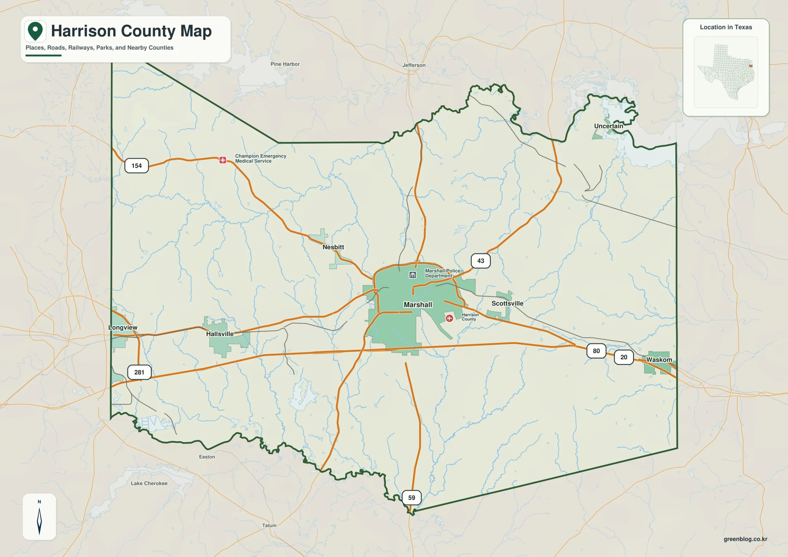
Harrison County in East Texas offers a diverse landscape defined by its central hub of Marshall, the I-20 corridor, intricate creek networks, and varied terrain ranging from western hills to southern river valleys.
Transportation Hubs and Community Layout
Marshall serves as the primary orientation point for travelers, situated at the intersection of major routes including I-20, U.S. 59, and Texas 43. The county's settlement pattern extends along this east-west axis, featuring Hallsville to the west, Scottsville just east of Marshall, and Waskom near the eastern edge. To the northwest lies Nesbitt, while smaller communities like Uncertain occupy the northeastern projection. Neighboring counties such as Gregg, Rusk, Panola, Marion, and Upshur provide additional geographic context, with Waskom acting as a key reference for travel toward the state line. A simplified city index highlights six ranked places, clarifying that Marshall is the largest settlement, followed by Hallsville and Waskom, while connector lines on this map represent straight-line distances rather than actual driving routes.
Water Systems and Topographical Variation
Beyond roads, the county's terrain is characterized by a complex drainage system including the Sabine River along the southwestern border, Little Cypress in the west, and numerous smaller creeks like Potters Creek and Eighteenmile Creek. Interior water features include Lake O' the Pines to the northwest and several lakes such as Holmes, Shadowood, Fern, and Highland within the county limits. The elevation map reveals significant topographical variation, with heights ranging from approximately 51 meters in lower stream valleys to 182 meters in higher western hills, averaging near 92 meters. These maps collectively illustrate how water cuts through the interior and how terrain changes across the region, offering a clearer picture than standard flat-road representations.


0 댓글