
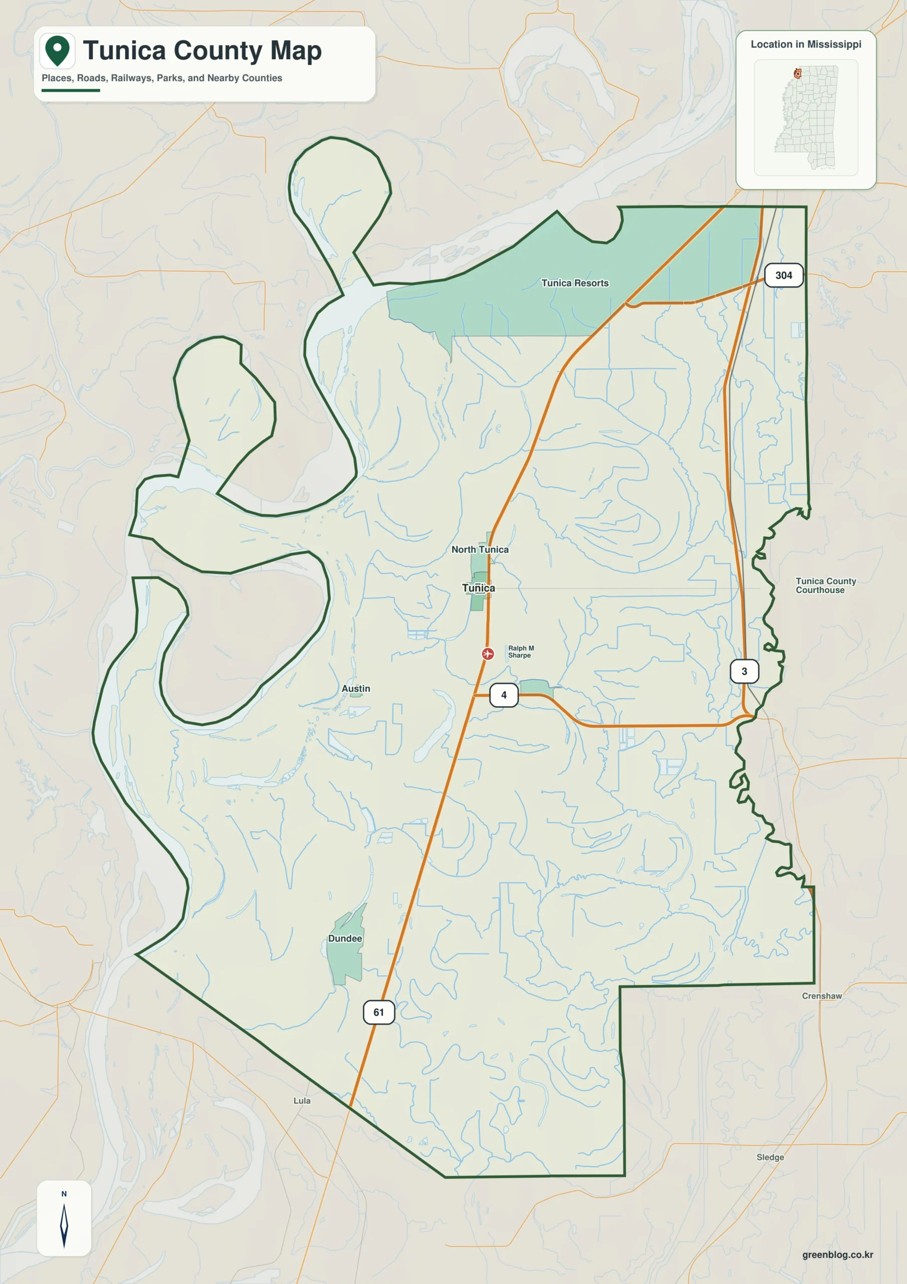
Tunica County presents a unique geographical landscape where the Mississippi River's complex history shapes the terrain. This region features a significant elevation range of approximately 16 to 98 meters, creating varied lowlands that include Old River Lake, Tunica Lake, and numerous bayous like White Oak Bayou and Coldwater River. Understanding these waterways and the separation between the inland county seat and the northern resort district is essential for navigating this area.
Navigating the Complex Geography of Water and Roads
The western boundary of Tunica County is defined by the winding Mississippi River, which creates broad bends and deep indentations that do not follow a simple straight line. While US 61 serves as the primary north-south corridor connecting Tunica to North Tunica and DeSoto County, travelers must account for the fact that visual proximity across river loops often requires indirect road routes. The county contains diverse water features including isolated lakes like Flower Lake and Cypress Lake, as well as interior channels such as Black Island Bayou and Core Bayou Cutoff. Although these smaller bodies of water do not offer navigability details found in specialized sources, they are crucial for understanding the flat floodplain's relief and drainage patterns that characterize the Delta lowlands.
Elevation Variations and District Distinctions
Topographical analysis reveals a mean elevation of about 56 meters across the county, with warmer brown tones dominating the north and northeast against greener low ground in the south. This subtle relief is visible through curving landforms that correspond to former river channels and current water features like Old River Chute. It is important to distinguish Tunica, the inland county seat, from Tunica Resorts located well to the north; they function as separate entities rather than a continuous downtown area. While the elevation map illustrates broad differences in terrain height between these regions, it should not be used alone for engineering or flood insurance decisions, which require more detailed datasets.


0 댓글