
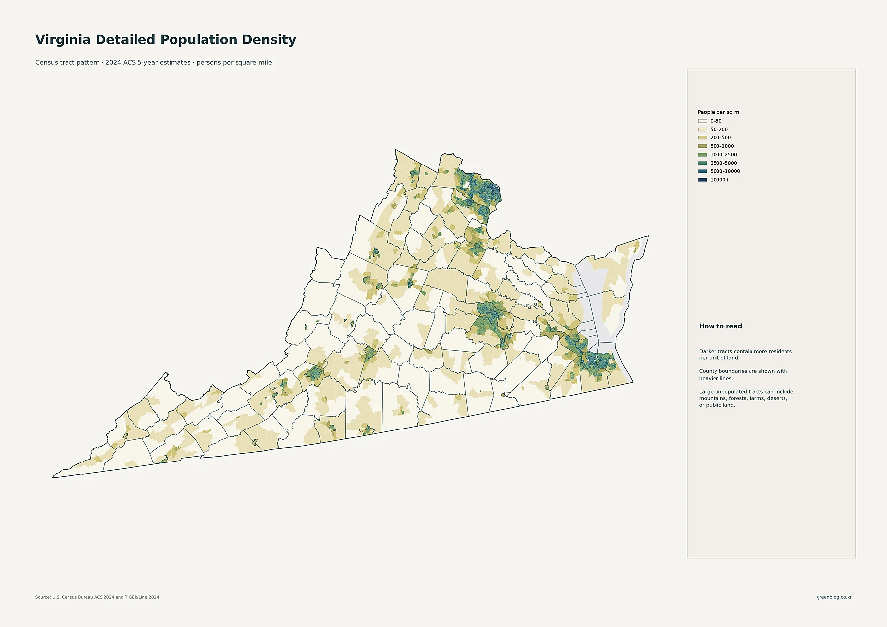
Virginia's population is defined by distinct urban systems rather than a single continuous sprawl, with Northern Virginia and Hampton Roads serving as the primary high-density anchors amidst broader rural landscapes.
The Dual Core of Urban Growth
Northern Virginia represents the state's most intense concentration of residents, anchored by Fairfax, Arlington, Alexandria, Loudoun, and Prince William counties. This region forms a cohesive settlement pattern extending from the Washington, D.C. edge westward. Within this cluster, Fairfax County holds the distinction of having over 1.1 million residents, making it the largest county-equivalent unit in Virginia. When measuring density specifically, Alexandria and Arlington lead by a significant margin, while Loudoun County drove the fastest population growth between 2010 and 2020. The map data reveals that this high-density pattern crosses multiple jurisdictional lines, appearing as one broad metropolitan system rather than isolated towns.
Hampton Roads and Regional Hubs
To the southeast, Hampton Roads creates a second major population center around Virginia Beach, Norfolk, Chesapeake, Newport News, Hampton, and Portsmouth. While waterways visually break up the region on maps, the settlement pattern remains a unified southeastern system. Norfolk and Portsmouth feature compact high-density areas, with higher concentrations continuing through Chesapeake and Virginia Beach. Virginia Beach stands out as the largest census place in the state with 456,349 residents, though it is not the densest area overall. The region also includes significant hubs like Richmond in central Virginia, surrounded by Henrico and Chesterfield counties, alongside smaller but distinct western centers such as Roanoke, Lynchburg, and Charlottesville.


0 댓글