
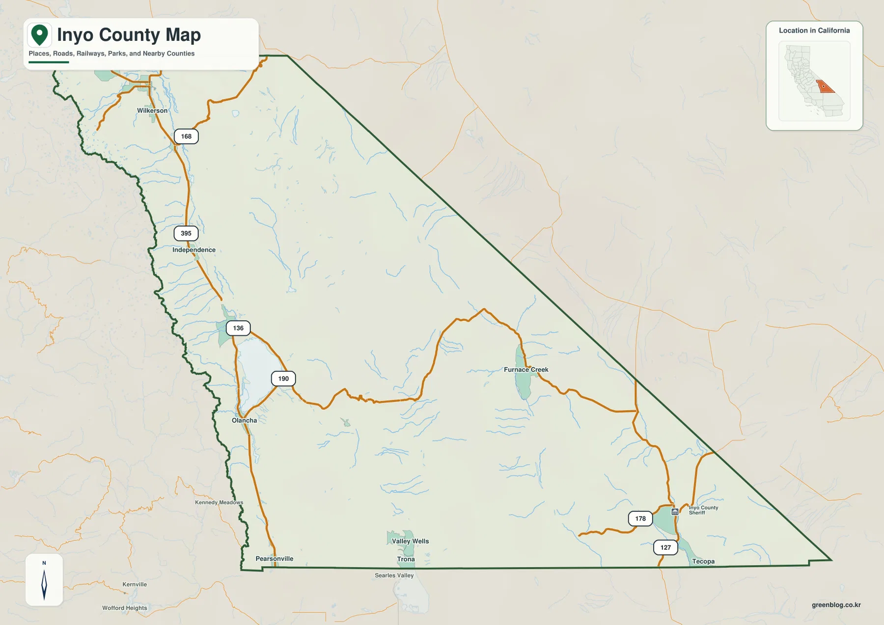
Inyo County spans a dramatic landscape between the Sierra Nevada and desert ranges, with travel largely defined by two main corridors: U.S. 395 through Owens Valley and State Route 190 leading toward Furnace Creek.
Transportation Corridors and Key Communities
Most established communities cluster along U.S. 395 in Owens Valley, forming a continuous north–south line that includes Bishop, Independence (the county seat), Lone Pine, and Olancha. This highway serves as the primary transportation reference for the western side of the county, connecting these towns while passing near historical sites like Manzanar National Historic Site. Farther east and southeast, settlement becomes sparse, dominated by mountain blocks and closed basins such as Furnace Creek, Tecopa, and Deep Springs Lake. State Route 190 acts as a critical secondary route, branching off U.S. 395 to link Owens Valley with Death Valley.
Municipal Structure and Geographic Features
Inyo County presents an unusual administrative pattern where Independence functions as the county seat since 1866, yet Bishop remains the only incorporated city. While demographic data often cites Bishop with a population figure of 3,778, many vital communities like Lone Pine, Big Pine, and Olancha remain unincorporated but essential for local geography and travel. The region's physical diversity is extraordinary, ranging from Mount Whitney to Badwater Basin in Death Valley. Water systems are organized by the Owens River and Tinemaha Reservoir on the western side, while the eastern desert features separate basins marked by Owens Lake and Salt Lake.


0 댓글