
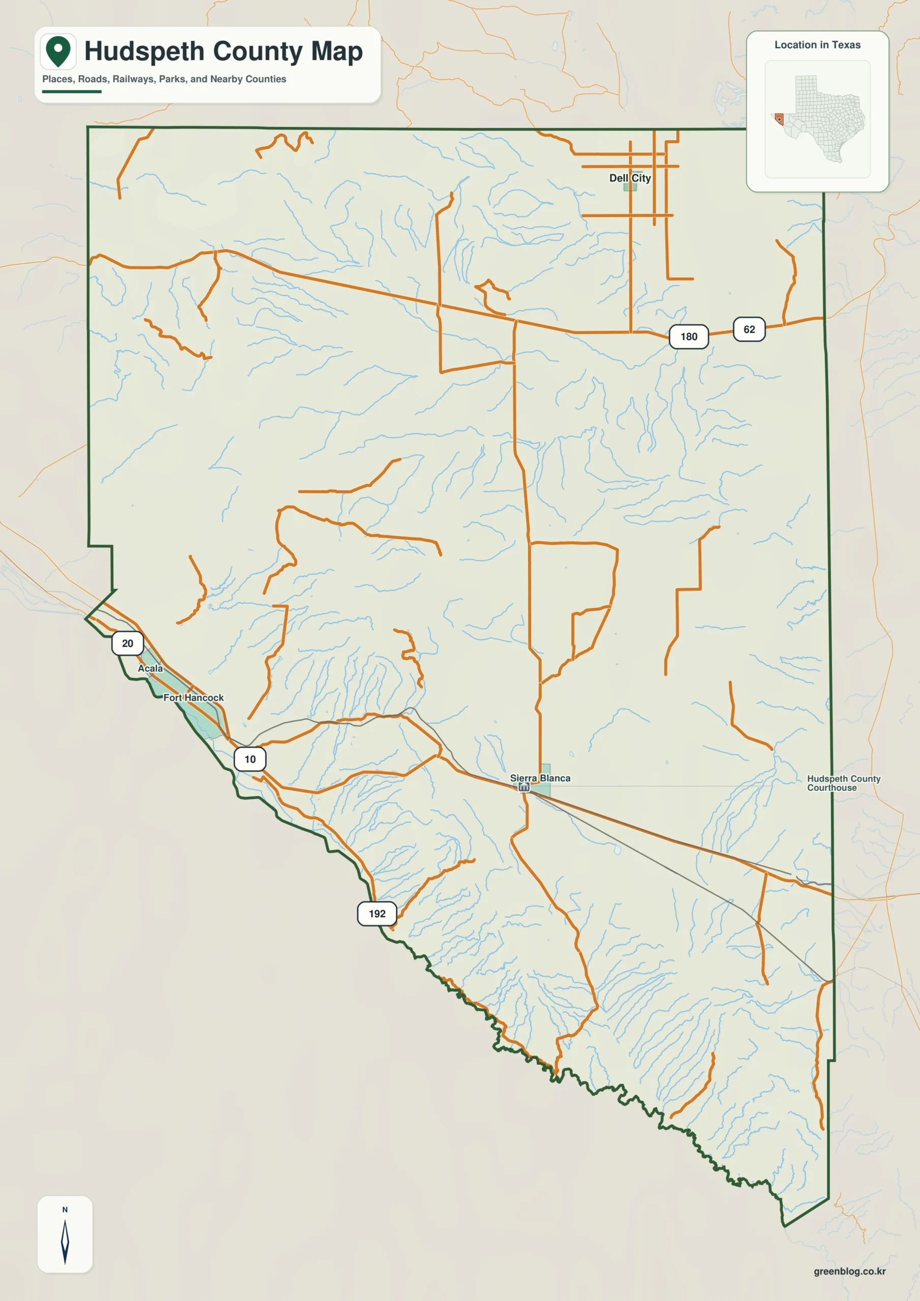
Hudspeth County in West Texas is defined more by its immense distances than by its urban centers, making it a landscape where Sierra Blanca, Fort Hancock, and Dell City exist as distinct regions separated by vast desert basins. Understanding the county requires viewing it not as a single compact area, but as a collection of travel zones connected only by specific corridors.
Distinct Travel Zones and Urban Distribution
The geography of Hudspeth County creates three primary settlement clusters that are separated by significant open space. Sierra Blanca, the county seat located near Interstate 10 in the south, serves as a practical anchor for the southern region alongside Fort Hancock and Acala on the Rio Grande side. In contrast, Dell City stands isolated to the northeast, connected primarily through the US 62/180 corridor. The city-distribution maps highlight Dell City due to its ranking status, yet this does not reflect administrative authority; Sierra Blanca remains the official county seat. Travelers must recognize that moving between these northern and southern settlements crosses long stretches of terrain with few labeled communities, reinforcing the reality that the county is an enormous expanse rather than a continuous urban strip.
Topography, Waterways, and Elevation
Beyond road networks, the physical landscape features a dramatic elevation range spanning from approximately 952 to 2,263 meters, with a mean near 1,351 meters. This vertical variation prevents the county from being described as uniformly flat desert, with green tones marking lower ground along the southwestern Rio Grande side and yellow, tan, and brown identifying higher mountain blocks in the east and southeast. The terrain-and-water maps reveal a dense network of drainage lines where short channels descend from elevated fronts toward basins. Notable water features include Camp Rice Arroyo, Arroyo Diablo, Madden Reservoir, Cavett Lake, Red Hills Arroyo, Echo Creek, and Grayton Lake. These arroyos and reservoirs provide fixed reference points that help visualize how water flows across the varied relief, connecting the higher ridges found in the northwest and interior to the lower convergence areas near the international border.


0 댓글