
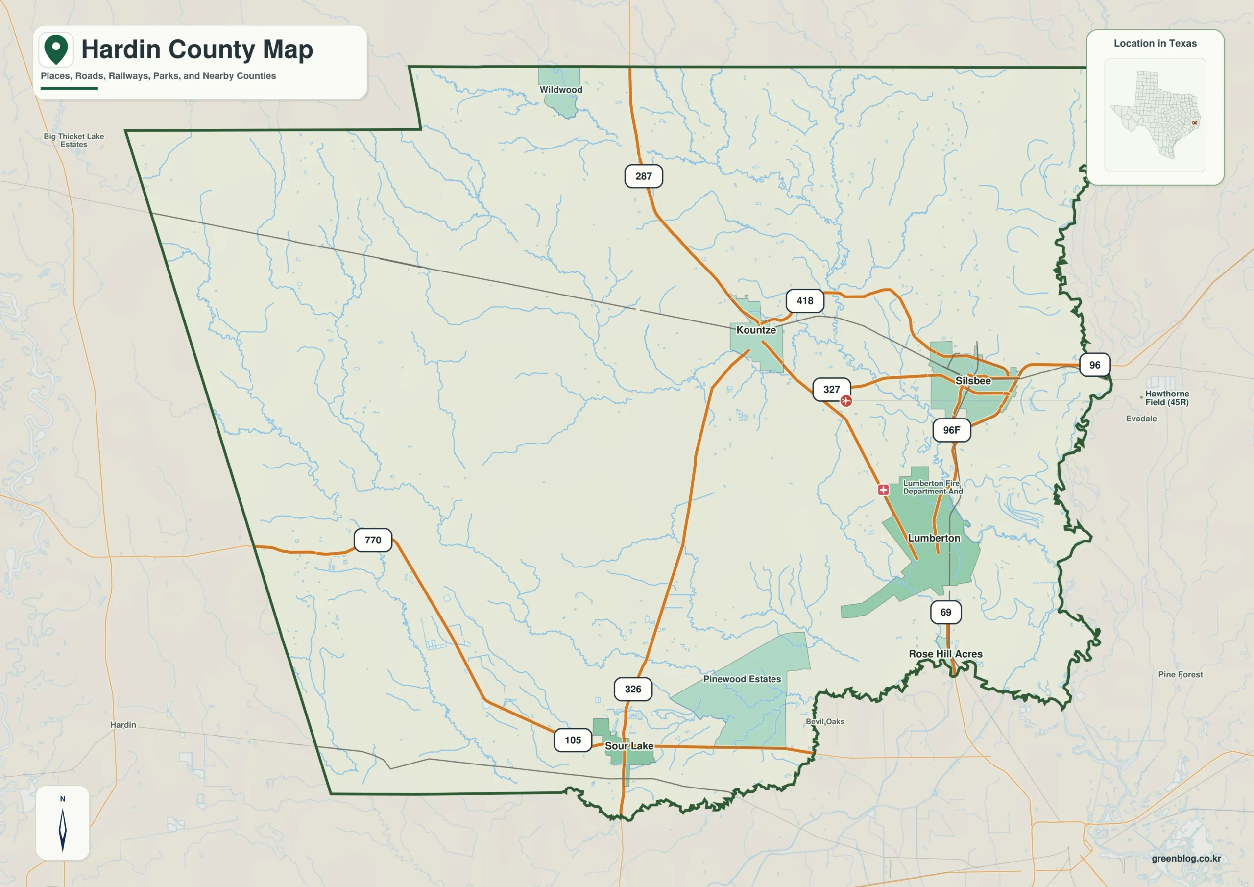
Hardin County in Southeast Texas offers a landscape defined by its dense network of waterways and distinct elevation changes rather than a uniform flat terrain. Understanding the county requires looking at how communities like Kountze and Silsbee connect via major routes while navigating the complex web of creeks and bayous that dissect the region.
Community Anchors and Road Networks
To orient yourself in Hardin County, focus on the eastern half where communities cluster closely together. Lumberton serves as a central hub in the southeast, connected to Silsbee to the northeast via State Highway 418 and U.S. Route 287. Kountze sits northwest of this pair along the same north-south corridor, while Sour Lake remains isolated in the southwest near Routes 105 and 326. This arrangement reveals that the county lacks a single compact settlement cluster; instead, the eastern communities form a connected network tied by major highways, whereas the western interior contains far fewer labeled population centers. The road system is not a perfect grid but follows the natural contours of the land, with numerous small streams visible beneath the surface influencing travel patterns.
Waterways and Topographical Relief
The physical landscape is dominated by a dense network of waterways that cover nearly every part of the county. Village Creek runs through the eastern side, intersecting with Pine Island Bayou, Big Sandy Creek, Cypress Creek, and many smaller channels like Mill Creek and Dry Creek. In the west, Cypress Creek and Flat Cypress Creek appear alongside Lake Kimball in the north and Massey Lake near the east. This creates a landscape divided by many creeks and low corridors rather than organized around a single river. Topographically, the county spans an elevation range from approximately -2 meters to 50 meters, with a mean near 22 meters. Brown and tan tones indicate higher ground concentrated in the northwest, while greens dominate the center, east, and southeast where the land is lower. Although the overall elevation is low compared to many inland Texas counties, the contrast between the northwest highlands and the southeastern lowlands provides a clear visual distinction for navigation.


0 댓글