
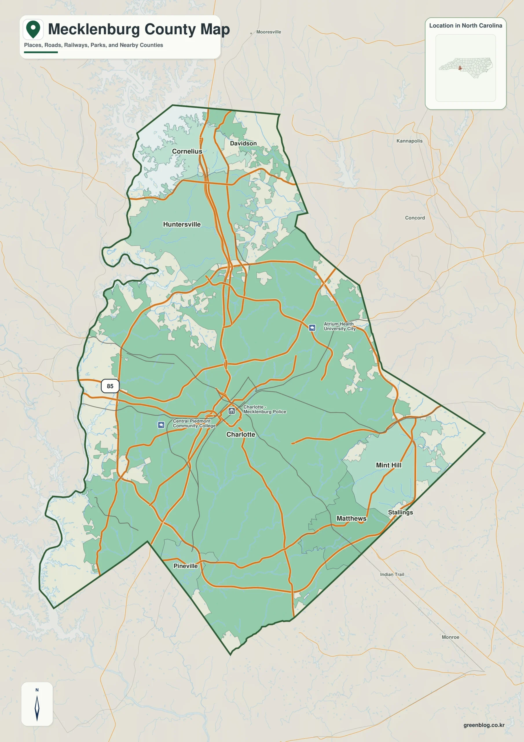
Mecklenburg County in North Carolina offers a diverse landscape where the urban density of Charlotte meets the expansive water systems of Lake Norman. Visitors seeking orientation can rely on three distinct map perspectives that reveal how major roads, town clusters, and terrain interact across the region.
Understanding Town Clusters and Road Networks
Charlotte serves as the central anchor for the county, but its geography becomes clearer when viewing surrounding communities separately. To the north, Huntersville, Cornelius, and Davidson form a cohesive group extending toward the large lake system, while Matthews and Mint Hill occupy the southeastern and eastern sectors. Pineville anchors the southern edge near the county boundary. The western and northwestern sides feature irregular shorelines that contrast sharply with the dense road grid found around Charlotte. Major corridors like I-85 are visible on the western side, connecting to a strong north-south route passing through the city. Neighboring cities such as Concord, Kannapolis, Mooresville, Indian Trail, and Monroe provide essential context for understanding why these local towns sit where they do relative to broader regional areas.
Water Systems and Terrain Visualization
When road details are removed, the intricate network of streams and reservoirs becomes the primary feature. Key waterways include the South Prong of Rocky River in the north, Long Creek crossing the west-central area, and Mallard Creek to the east. Smaller systems like Little Sugar Creek and McAlpine Creek drain different sections south of central Charlotte and toward Matthews. Labeled water bodies such as Charlotte Reservoir, Eagle Lake, Ferrelltown Lake, and several smaller reservoirs help identify specific locations that are often overlooked on standard road maps. The terrain itself is characterized by gentle low ridges and shallow valleys rather than the steep mountains found in western North Carolina. This subtle topography guides the stream networks across the developed metropolitan area, offering a complete picture of how the built environment rests upon the underlying landscape.


0 댓글