
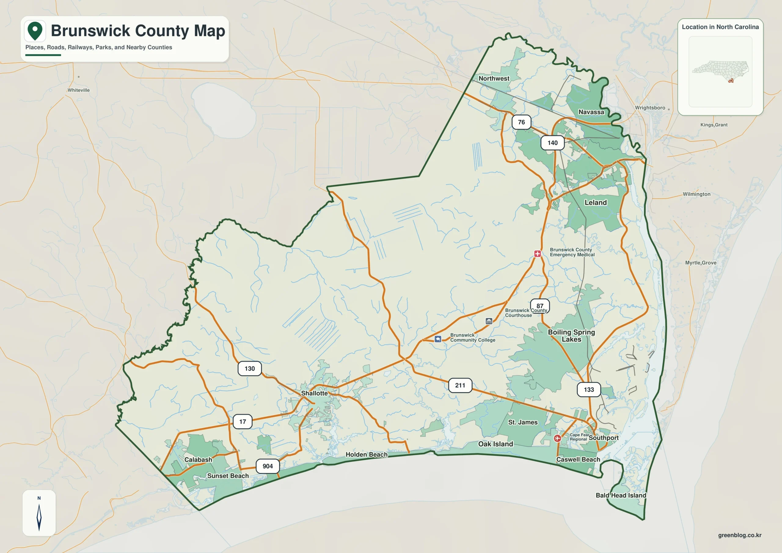
Brunswick County in southeastern North Carolina presents a complex geography where inland roads, tidal waterways, and Atlantic communities coexist within a single irregular outline. Rather than viewing the area as one compact unit, understanding its layout requires separating three distinct map perspectives: the general county boundary, the distribution of major cities, and the intricate network of rivers and coastlines.
Separating Administrative Centers from Coastal Clusters
The county's geography defies a simple central point. Leland, holding the largest population value at 29,607, anchors the northeastern edge near Wilmington and Navassa. In contrast, Shallotte sits far to the southwest, while Oak Island, Southport, Caswell Beach, and Bald Head Island line the southern and southeastern coast. This separation means that the county seat in the south-central interior does not represent the geographic center of all settlements. The city-distribution map clarifies this by isolating six major communities: Leland (29,607), Oak Island (9,030), St. James (7,072), Boiling Spring Lakes (6,467), Carolina Shores (5,017), and Shallotte (4,639). These populations form three distinct clusters rather than a single group around an administrative hub like Bolivia, which serves as a reference point but is not the largest city.
Road Corridors and the Extensive Water Network
Transportation and waterways define the county's internal structure more than a single river. Major road numbers create clear links between regions; Route 17 connects the southwestern Shallotte area to the northeastern Leland region, while Routes 87 and 133 organize the south-central side. The water geography is equally diverse, featuring the Cape Fear River flowing toward the ocean alongside the Intracoastal Waterway and various creeks. This network dominates the eastern and southern margins, creating a coastline that stretches from Calabash and Sunset Beach in the southwest to Holden Beach and Oak Island in the center. Understanding these separate corridors prevents the mistake of assuming all coastal features belong to one continuous zone.


0 댓글