
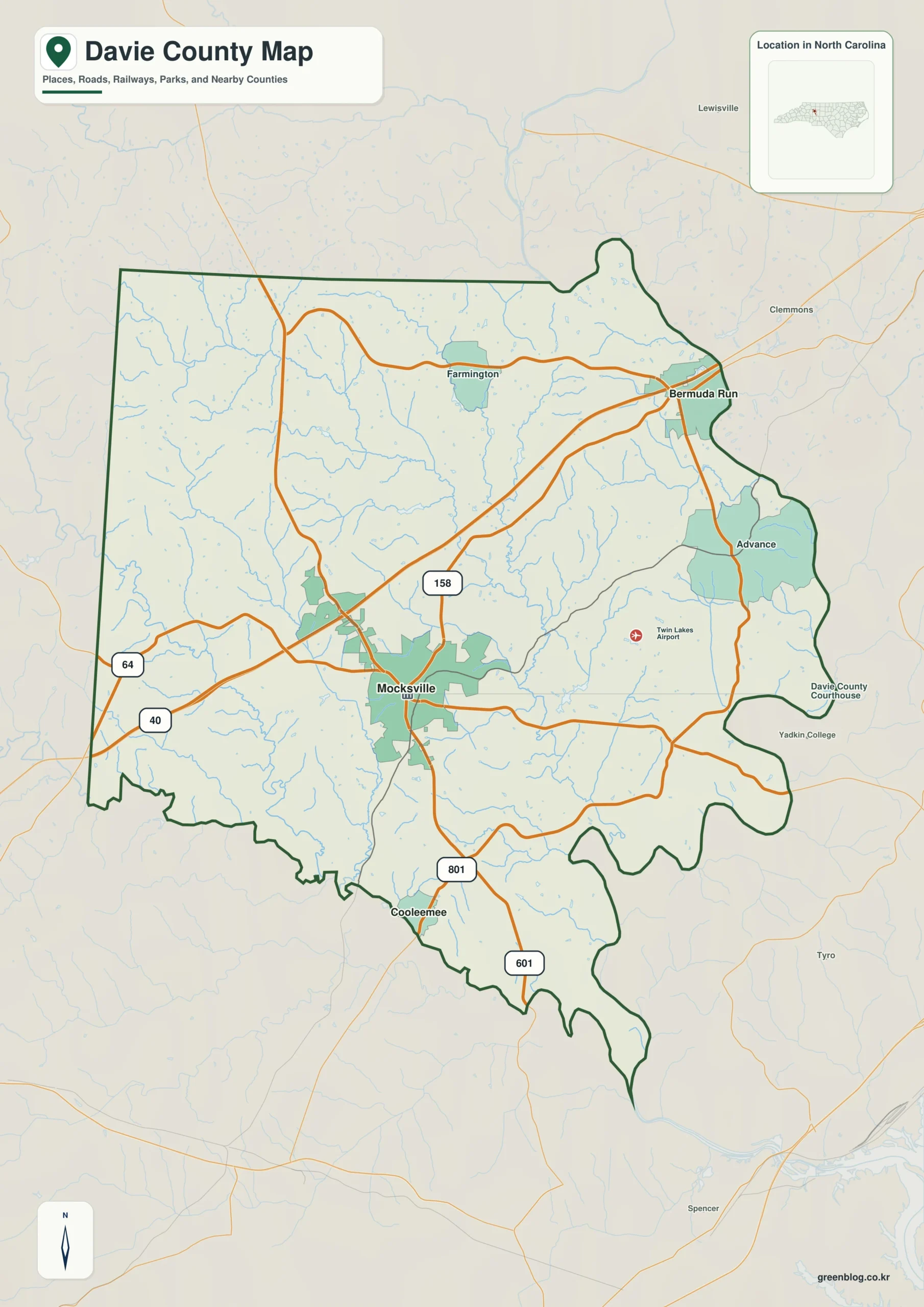
Davie County offers a distinct geography where road networks in the center contrast sharply with natural waterways along the southern edge. Understanding the relative positions of Mocksville, Bermuda Run, and Cooleemee is essential for anyone navigating this region.
Roads and Cities: The Central and Northeast Framework
Mocksville serves as the practical anchor for the county's road network, situated near the middle of Davie County. Major routes like I-40, US 64, and US 158 converge here, making it the clearest reference point for orientation even when traveling to distant towns. To the northeast, Bermuda Run occupies a different spatial reality than Mocksville; while Mocksville remains central, Bermuda Run lies close to the county edge near Clemmons and Lewisville. This area also includes Advance, which sits south of Bermuda Run, whereas Farmington is located farther west across the northern section. These distinct positions reveal that Davie County extends significantly beyond a simple compact description, with the northern half spreading across multiple directions while the southern half narrows toward the river corridor.
Waterways and the Southern Boundary
The southern side of the county is defined less by roads and more by the South Yadkin River. Cooleemee lies much farther south near this river corridor, providing a natural reference that differs entirely from the road-focused interior. The South Yadkin River follows the lower portion of the county before continuing eastward toward the broader Yadkin River on the eastern side. This geography creates an irregular county boundary in the south, distinct from the straighter road patterns found elsewhere. Interior streams such as Cedar Creek, Bear Creek, Hunting Creek, and several small lakes feed into this larger network, adding detail that standard road maps cannot display. Viewing these water features alongside the city locations offers a complete picture of Davie County's unique landscape.


0 댓글