
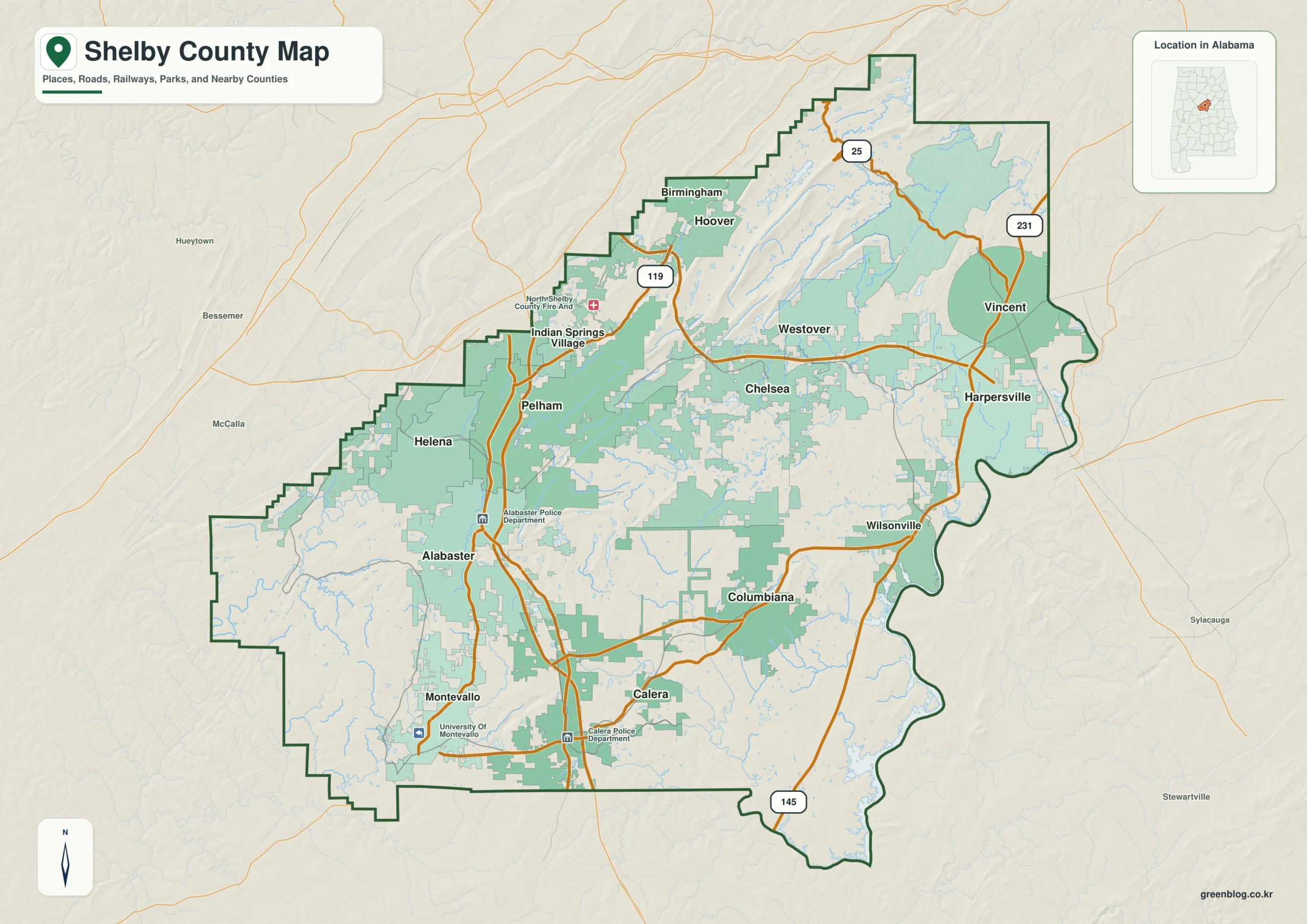
Shelby County in Alabama is best understood not as a single suburban block, but as a collection of distinct landscapes ranging from Birmingham's southern edge to the eastern river country. The area features significant topographical variation, with northern and central ridges rising between 60 and 470 meters above sea level, contrasting sharply with the lower elevations near the Cahaba and Coosa River systems.
Transportation Corridors and Urban Centers
The county's layout is defined by two primary travel routes. The I-65 corridor connects major northern suburbs like Pelham, Alabaster, and Calera to Birmingham, while U.S. 280 runs southeast through Chelsea and Harpersville. Although Alabaster holds the highest population among the six ranked cities listed (33,917), Columbiana serves as the essential county seat despite not being the largest place on the city map. The general map illustrates how these different centers function within a broader context that includes neighboring counties such as Jefferson, St. Clair, and Tuscaloosa.
Topography and Water Systems
Beyond roads, Shelby County offers a complex water geography. The western side drains into the Cahaba River system, while the eastern edge is influenced by the Coosa River and Lay Lake. A dedicated water map reveals a dense network of creeks, small lakes, and named features like Oak Mountain Lake that fill the interior spaces between these major river systems. This topographical diversity explains why the county does not look or function uniformly, requiring separate maps for roads, settlements, and elevation data to fully grasp the region.


0 댓글