
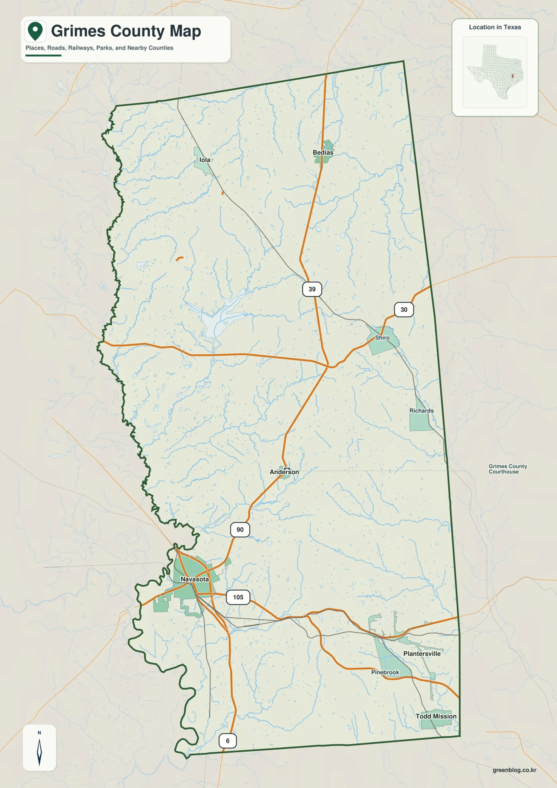
Grimes County in southeast-central Texas presents a diverse landscape defined by its irregular western edge and straighter eastern boundary. This region is characterized by the convergence of major waterways, distinct elevation changes, and a settlement pattern that stretches from Navasota northward toward Anderson and smaller communities like Bedias and Iola.
Geography and Hydrology
The county's physical character is dominated by the Brazos and Navasota rivers, which frame a dense network of smaller creeks and lakes along the western side. The terrain elevation ranges from approximately 41 meters in the broad river bottoms to 144 meters in the broken central and eastern uplands. While low green areas follow the western water corridors, higher relief becomes more common moving eastward, creating a rolling, dissected appearance rather than a uniform surface. Key water features include Gibbons Creek in the central-western area, Pine Creek in the northeast, and several scattered lakes such as Lake Wayne, K-ranch Lake, and Stoneham Lake.
Settlement and Transportation
A long settlement pattern runs from Navasota, the strongest visual anchor near the southwest side, north toward Anderson. Highway 90 connects these two primary cities, while other routes like Highway 105, 39, and 30 link smaller communities such as Plantersville, Bedias, Iola, Shiro, and Richards. Navasota stands apart as the dominant urban reference point, with six ranked communities mapped across the county. The dispersion of these towns, combined with neighboring counties like Brazos, Washington, and Madison to the west and north, provides essential context for understanding the region's infrastructure and rural distances.


0 댓글