
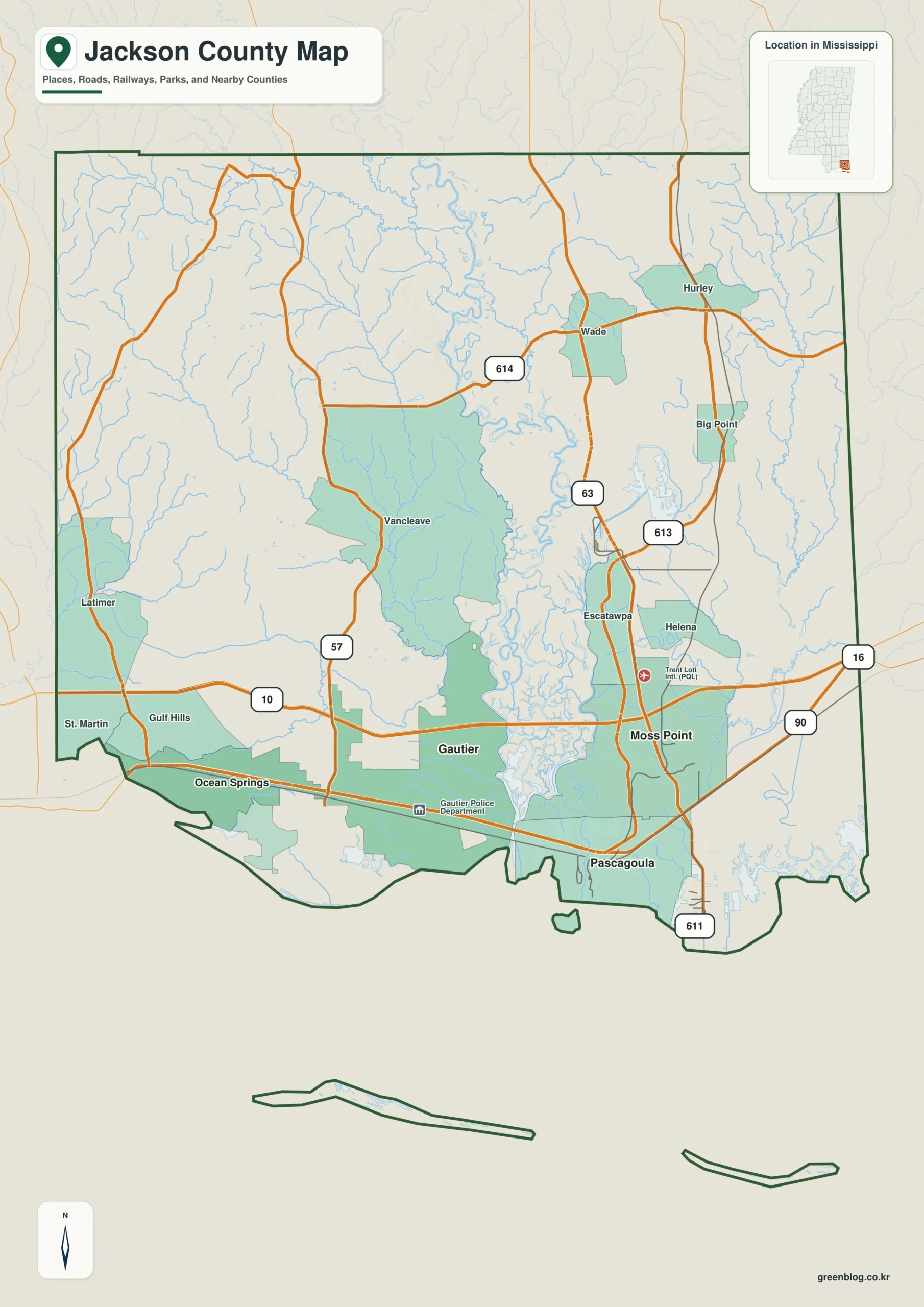
Jackson County presents a striking geographical duality, stretching from the low-lying waters of the Mississippi Sound deep into the elevated river country of southeastern Mississippi. This unique landscape is defined by a sharp contrast between its southern coastal communities and its northern inland settlements, creating a distinct environment for travel and settlement.
Coastal Communities and Inland Expansion
The county's geography is anchored by four major coastal cities: Pascagoula, Moss Point, Gautier, and Ocean Springs. These urban centers cluster near the eastern estuary and western coast, separated by straight-line distances ranging from five to fourteen miles. While these cities are relatively close in terms of direct distance, road networks like US 90 and I-10 connect them through a dense southern belt. In contrast, towns such as Vancleave, Wade, and Hurley extend the county's reach well north of the shoreline, where terrain becomes more textured with small ridges and valleys. The population distribution reflects this layout, with Pascagoula serving as the county seat and home to over 143,000 residents in the 2020 census.
Elevation and Hydrological Features
Understanding Jackson County requires acknowledging its dramatic elevation changes, which span from approximately -1 meter at the coast to 62 meters in the northwest. The southern half is dominated by a very low landscape featuring the Pascagoula River, West Pascagoula River, and Escatawpa River, which feed into numerous estuary channels and bays like Old Fort Bayou before opening into Mississippi Sound. This hydrological network creates a complex waterway system that differs significantly from the higher ground found inland. Although the elevation surface is generalized for broad reference rather than engineering precision, it clearly illustrates how modest elevations create strong visual contrasts between the coastal lowlands and the interior terrain.


0 댓글