
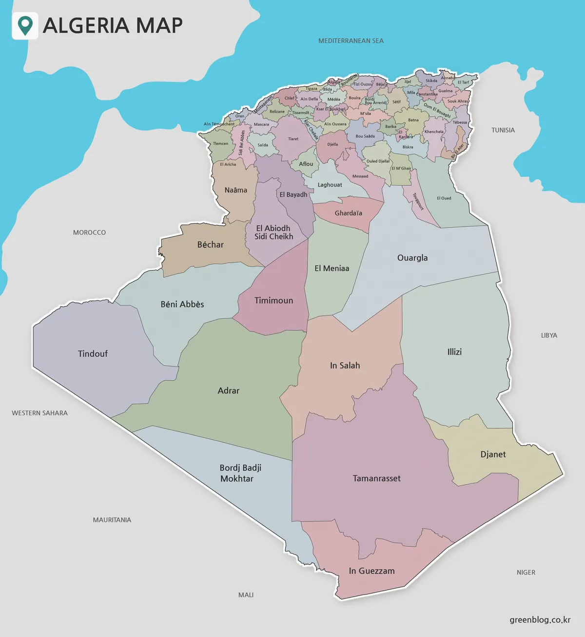
Algeria has undergone a significant territorial reorganization, officially established by Law No. 26-06 on April 4, 2026, which increased the number of administrative districts from 58 to 69. This legal framework, published in Official Journal No. 25 on April 5, 2026, introduced eleven new full wilayas including El Aricha, Aïn Oussera, and Messaad. To assist researchers and educators, a specialized map collection featuring three distinct visual formats has been prepared. These resources utilize the same geometric boundaries to facilitate comparison and annotation without altering the underlying territorial structure.
Understanding the Visual Formats
The provided set includes an unlabeled outline, a black-and-white labeled reference, and a color-coded version. Each image measures 1200 × 1307 pixels in portrait orientation. The labeled versions explicitly name all 69 wilayas alongside neighboring countries such as Morocco, Tunisia, Libya, Niger, Mali, Mauritania, and Western Sahara, providing essential context for regional orientation. It is important to note that these maps do not depict roads, elevation data, or tourist sites; they serve strictly as first-level administrative references.
Why the North and South Appear Different
The visual disparity between Algeria's northern coastal region and its southern Sahara is a reflection of actual administrative boundaries rather than graphic distortion. The north features numerous compact provinces like Algiers, Tipaza, and Blida with dense labeling, while the south contains expansive units such as Tamanrasset and Adrar. To verify if a map reflects the 2026 system, users should look for the specific names of the eleven newly established wilayas, particularly El Aricha in the northwest and Bir El Ater along the eastern side.
Practical Applications
The unlabeled outline is ideal for classroom activities where students can practice labeling or creating their own annotations. The black-and-white version offers high contrast for tracing boundaries and adding hand-drawn notes, while the color map aids in distinguishing adjacent regions quickly. Users must remember that these are raster images suitable for educational graphics but not for precise coordinate analysis or legal surveying work.


0 댓글